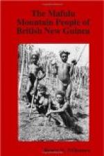
So far I have not referred to a Negrito element in the Ethnology of New Guinea. From time to time we have heard rumours of pygmy people, and German travellers have recorded very short individuals in Kaiser Wilhelm’s Land; but it was not till the expedition to Netherlands New Guinea of the British Ornithological Union of 1910-11 that a definite pygmy race was demonstrated. I think this can be no longer denied, and the observations made by German ethnologists show that the race in a more or less modified state is widely spread. Now Mr. Williamson, whose work in New Guinea was contemporaneous with that of the Netherlands New Guinea expedition, adduces evidence that this is also the case in British territory. It is worth recalling that de Quatrefages and Hamy (Crania Ethnica, 1882, pp. 207-210, 253-256) distinguish a “Negrito-Papuan” and a “Papuan” element in the Torres Straits. This problem will be discussed in Vol. I. of the Reports of the Cambridge Expedition to Torres Straits. I feel little doubt that Mr. Williamson has shown strong evidence that the Mafulu and probably other adjacent mountain tribes are essentially a pygmy—that is to say a Negrito—people who have been modified to some extent by Papuan and possibly Papuo-Melanesian influence, both physical and cultural. He has marshalled his data with great skill, and has dissected out, as it were, the physical and cultural elements of the Negrito substratum. It only remains for other observers to study Negritos in other parts of New Guinea to see how far these claims can be substantiated. It is evident therefore that, apart from the valuable detailed information which Mr. Williamson has given us concerning a hitherto unknown tribe, he has opened up a problem of considerable interest and magnitude.
A.C. Haddon.
THE MAFULU MOUNTAIN PEOPLE OF BRITISH NEW GUINEA
CHAPTER I
Introductory
The map appended to this volume is (with the exception of the red lines and red lettering upon it) a reproduction of a portion of the map relating to the explorations and surveys of Dr. Strong, Mr. Monckton and Captain Barton, which was published in the Geographical Journal for September, 1908, and the use of which has been kindly permitted me by the Royal Geographical Society. I have eliminated the red route lines which appear in the original map, so as to avoid confusion with the red lines which I have added. The unbroken red lines and the red lettering upon my map are copied from a map, also kindly placed at my disposal, which has been recently prepared by Father Fillodean of the Mission of the Sacred Heart, and these lines mark roughly what the Fathers of the Mission believe to be the boundaries of the several linguistic areas within the district covered by their map. It will be observed that some of these lines are not continued


